ဖိုင်:Vanuatu location map.svg

Size of this PNG preview of this SVG file: ၃၂၄ × ၅၉၉ ပစ်ဇယ်. အခြား ပုံရိပ်ပြတ်သားမှု: ၁၃၀ × ၂၄၀ ပစ်ဇယ် | ၂၅၉ × ၄၈၀ ပစ်ဇယ် | ၄၁၅ × ၇၆၈ ပစ်ဇယ် | ၅၅၃ × ၁၀၂၄ ပစ်ဇယ် | ၁၁၀၇ × ၂၀၄၈ ပစ်ဇယ် | ၆၂၅ × ၁၁၅၆ ပစ်ဇယ်။
မူရင်းဖိုင် (SVG ဖိုင်, ၆၂၅ × ၁၁၅၆ pixels ကို အကြံပြုသည်, ဖိုင်အရွယ်အစား - ၇၉ KB)
အကျဉ်းချုပ်
| Camera location | | View this and other nearby images on: OpenStreetMap |
|---|
| ဖော်ပြချက် |
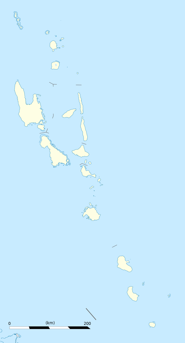
Equirectangular projection, WGS84 datum
Geographic limits of the map:
|
||
| ရက်စွဲ | |||
| ရင်းမြစ် |
ကိုယ်ပိုင်ဖန်တီးမှု
|
||
| စာရေးသူ | Eric Gaba (Sting - fr:Sting) | ||
| ခွင့်ပြုချက် (ဤဖိုင်ကို ပြန်လည်အသုံးပြုခြင်း) |
|
||
| အခြား ဗားရှင်းများ |
|

လိုင်စင်သတ်မှတ်ခြင်း
ကျွန်ုပ်၊ ဤလုပ်ဆောင်ချက်၏ မူပိုင်ခွင့်ပိုင်ရှင်အနေဖြင့် ဤနေရာမှ အောက်ပါလိုင်စင်များအောက်တွင် ထုတ်လွှင့်ပါသည်:
ဤဖိုင်ကို Creative Commons Attribution-Share Alike 3.0 Unported လိုင်စင်ဖြင့် သတ်မှတ်ထားသည်။
- သင်သည် လွတ်လပ်စွာ:
- မျှဝေရန် – ဖန်တီးမှုကို ကူးယူရန်၊ ဖြန့်ဖြူးရန်နှင့် ထုတ်လွှင့်ရန်
- ပြန်ရောနှောရန် – ဖန်တီးမှုကို ပြင်ဆင်ညှိနှိုင်းရန်
- အောက်ပါ အခြေအနေများတွင်:
- မှတ်ယူနိုင်ခြင်း – ပြောင်းလဲမှုများ ပြုလုပ်ခဲ့ပါက ဖန်တီးသူ သို့မဟုတ် လိုင်စင်ရှိသူမှ သတ်မှတ်သော အမျိုးအစားကို လိုက်နာရမည် (ဆိုလိုသည်မှာ သင့်အား သို့မဟုတ် သင့်ဖန်တီးမှုတွင် အသုံးပြုခြင်းအား ထောက်ခံချက်ပေးသည်ဟု မဆိုလိုပါ)။
- ထပ်တူမျှဝေ – ဤဖန်တီးမှုအား ပြင်ဆင်ခြင်း၊ ပြောင်းလဲခြင်း သို့မဟုတ် ထပ်ဆင့် ဖန်တီးခြင်း ပြုလုပ်ပါက ရရှိလာသော ဖန်တီးမှုကို ဤဖန်တီးမှုနှင့် သို့မဟုတ် ဆင်တူသော လိုင်စင်ဖြင့်သာ ဖြန့်ချိသင့်သည်။

|
ဤစာတမ်းကို GNU Free Documentation License, ဗားရှင်း ၁.၂ သို့မဟုတ် Free Software Foundation မှ ဖြန့်ချီထားသော မည်သည့်ယခင်ဗားရှင်းတစ်ခုခုအောက်တွင် Invariant Sections, Front-Cover Texts နှင့် Back-Cover Texts များမပါဝင်ဘဲ ကူးယူခြင်း၊ ဖြန့်ချီခြင်း နှင့်/သို့မဟုတ် ပြင်ဆင်ပြောင်းလဲနိုင်ရန် ခွင့်ပြုသည်။ လိုင်စင်မူပွားကို GNU Free Documentation License ခေါင်းစဉ်အောက်တွင် ထည့်သွင်းထားသည်။ |
သင်အလိုရှိရာ လိုင်စင်ကို ရွေးချယ်နိုင်ပါသည်။
ဖိုင်မှတ်တမ်း
ဖိုင်ကို ယင်းနေ့စွဲ အတိုင်း မြင်နိုင်ရန် နေ့စွဲ/အချိန် တစ်ခုခုပေါ်တွင် ကလစ်နှိပ်ပါ။
| နေ့စွဲ/အချိန် | နမူနာပုံငယ် | မှတ်တမ်း ဒိုင်မန်းရှင်းများ | အသုံးပြုသူ | မှတ်ချက် | |
|---|---|---|---|---|---|
| ကာလပေါ် | ၁၉:၀၂၊ ၂၁ အောက်တိုဘာ ၂၀၁၃ | | ၆၂၅ × ၁၁၅၆ (၇၉ KB) | TUBS | +provincial seaborders and matching int'l maritime borders |
| ၂၂:၁၂၊ ၂၁ ဇန်နဝါရီ ၂၀၀၉ |  | ၆၂၅ × ၁၁၅၆ (၁၃၄ KB) | Sting | == Summary == {{Location|16|42|00|S|168|24|00|E|scale:3000000}} <br/> {{Information |Description={{en|Blank administrative map of Vanuatu in Oceania, for geo-location purposes.}} {{fr|Carte administrative vierge de [[:fr:Va |
ဖိုင်သုံးစွဲမှု
ဤဖိုင်ကို အသုံးပြုထားသော စာမျက်နှာများမရှိပါ။
ဂလိုဘယ် ဖိုင်သုံးစွဲမှု
အောက်ပါ အခြားဝီကီများတွင် ဤဖိုင်ကို အသုံးပြုထားသည်-
- af.wikipedia.org တွင် အသုံးပြုမှု
- an.wikipedia.org တွင် အသုံးပြုမှု
- ar.wikipedia.org တွင် အသုံးပြုမှု
- ast.wikipedia.org တွင် အသုံးပြုမှု
- Puertu Villa
- Módulu:Mapa de llocalización/datos/Vanuatu
- Módulu:Mapa de llocalización/datos/Vanuatu/usu
- Aeropuertu Internacional Bauerfield
- Aeropuertu Internacional de Santo-Pekoa
- Malakula
- Aore
- Luganville (Vanuatu)
- Monte Tabwemasana
- Maewo
- Erromango
- Islla de Pentecostés
- Aneityum
- Vanua Lava
- Islla Epi
- Ambae
- Gaua
- Efate
- Islla Espíritu Santo (Vanuatu)
- Ambrym
- Islla Tanna
- az.wikipedia.org တွင် အသုံးပြုမှု
- ba.wikipedia.org တွင် အသုံးပြုမှု
- be-tarask.wikipedia.org တွင် အသုံးပြုမှု
- be.wikipedia.org တွင် အသုံးပြုမှု
- bg.wikipedia.org တွင် အသုံးပြုမှု
- bn.wikipedia.org တွင် အသုံးပြုမှု
- bs.wikipedia.org တွင် အသုံးပြုမှု
- ceb.wikipedia.org တွင် အသုံးပြုမှု
ဤဖိုင်ကို အခြားနေရာများတွင် အသုံးပြုထားမှုများအား ကြည့်ရှုရန်။